

People & Programs
Disaster-Proofing U.S. Infrastructure
DesignSafe, a platform for the natural hazards community, helps researchers build a more resilient society
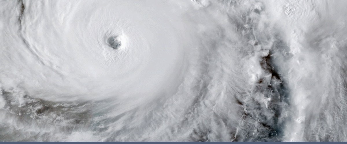
The 2017 hurricane season was one of the worst on record. Seventeen named storms caused thousands of fatalities, incurred more than $280 billion in damages, and disrupted millions of lives.
We may not be able to prevent hurricanes from occurring, but we can improve our ability to predict them, move people out of harm's way, respond quickly to their aftermath, and build our homes and infrastructure in a way that can survive major storms.
A web-based research platform called DesignSafe helps researchers manage, analyze, and understand critical information about natural hazards — from earthquakes and tornadoes to hurricanes and sinkholes. It is supported by grants from the National Science Foundation and is developed at TACC in collaboration with partners at the UT Austin Cockrell School of Engineering, Rice University, and Florida Institute of Technology.
DesignSafe helps prevent natural hazards from becoming societal disasters.
Powering Post-Storm Reconnaissance
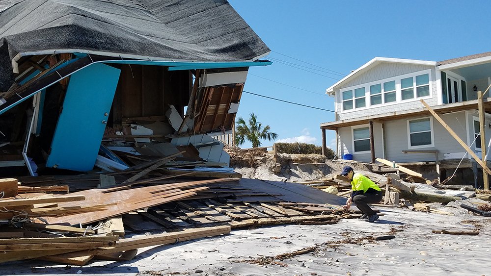
David Roueche, an assistant professor of Civil Engineering at Auburn University, was on the front lines of the 2017 hurricane response. He participated in post-storm reconnaissance missions to coastal Texas, the Florida Keys, Puerto Rico, and several Caribbean islands.
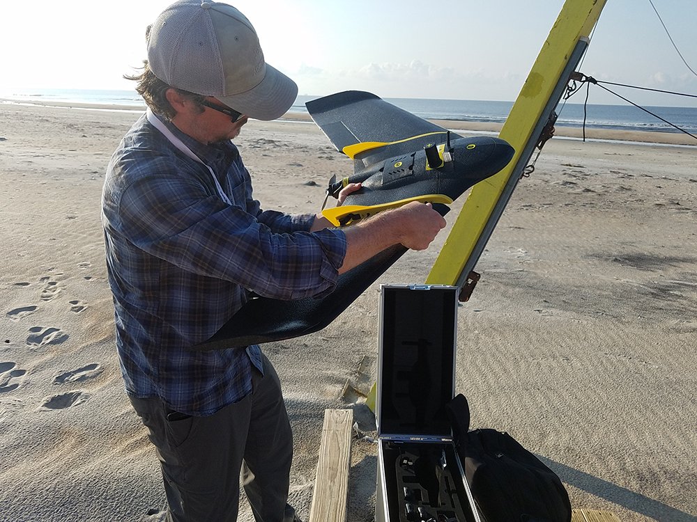
Roueche and his collaborators inspected thousands of homes after Hurricanes Harvey, Irma, and Maria, uploading tens of thousands of photographs captured by ground-based teams and unmanned aerial vehicles.
The 2017 hurricane season put DesignSafe to the test.
Roueche and his team coordinated their deployments via a community channel established by DesignSafe. They used wind map data shared on DesignSafe to determine where they would focus their efforts. They uploaded their field data to DesignSafe and used software within DesignSafe to generate maps that synthesized their and others' data collections. DesignSafe's Reconnaissance Portal, which launched in 2017, provided both the computing capabilities Roueche needed for his analyses, and a place to share more than 200 gigabytes of gathered data.
The engineers found examples of houses side-by-side, built around the same time, where one was completely destroyed and the other was intact. What factors influenced survival? And how could rebuilding efforts be improved by understanding what features led some structures to withstand storms?
"We were interested in capturing data about structures before they were destroyed, torn down, and rebuilt," Roueche said. "Typically, it takes one to five years before products from the data are formally published. That doesn't allow us to help communities in rebuilding."
With DesignSafe, recommendations can be disseminated in months rather than years, accelerating what Roueche calls the ‘resilience curve': the time it takes a community to fully recover from a disaster.
"By having a more streamlined workflow, standardizing processes, and publishing data sooner, DesignSafe allows us to affect the reconstruction process and have a greater impact," Roueche said.
Creating Street-Level Forecasts of Hurricane Impacts
Working at the front-lines of Hurricane Harvey also inspired the creation of new tools to assist first responders. At the Texas State Operations Center, Dan Stanzione, TACC's executive director and a co-principal investigator for DesignSafe, assisted decision-makers during Hurricane Harvey.
"While there, a first responder said to me: ‘I want to know a list of addresses in Houston that have been flooded above their electrical outlet height. You have a supercomputer, you can do that right?'" Stanzione recalled. "We weren't able to provide that assistance in the moment, but it inspired us to create such a tool."
The data needed for the analysis, such as storm surge forecasts, elevation maps, and home constructions records, were all in place. But the ability to connect these datasets and generate a list of potentially damaged homes in a reasonable amount of time was not.
So, researchers on the DesignSafe team created tools to stitch together simulations and data across scales, from the entirety of the Gulf of Mexico to a particular stretch of coastline, and from individual neighborhoods to specific homes.
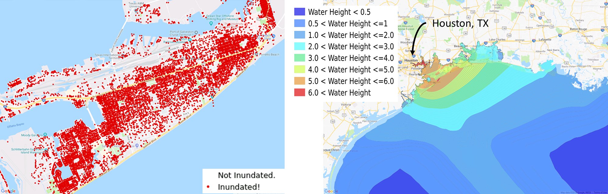
Using 2008's Hurricane Ike as a test case, the DesignSafe team showed that they could generate, in real-time, a list of potentially damaged homes. In fact, all aspects of the process could be computed within DesignSafe, using TACC's supercomputers in the background.
"We can go from Gulf-wide, large-scale simulations to, ‘Did this house flood or not?'" Stanzione said. "It's a long-time goal that was not technologically possible before, but that we've been able to achieve."
When Hurricane Florence hit the mid-Atlantic coast in 2018, natural hazard researchers were ready to act. Multiple field reconnaissance teams relied on DesignSafe to coordinate their efforts, identify high impact targets, share data, and make decisions.
"DesignSafe is truly changing the way we plan, perform, and document our reconnaissance efforts," noted Ellen Rathje, principal investigator for DesignSafe and the Janet S. Cockrell Chair in Engineering at UT Austin. "I have been participating in natural hazards reconnaissance for 20 years, and I've never seen anything like this. It's very exciting."