Visualizing Science
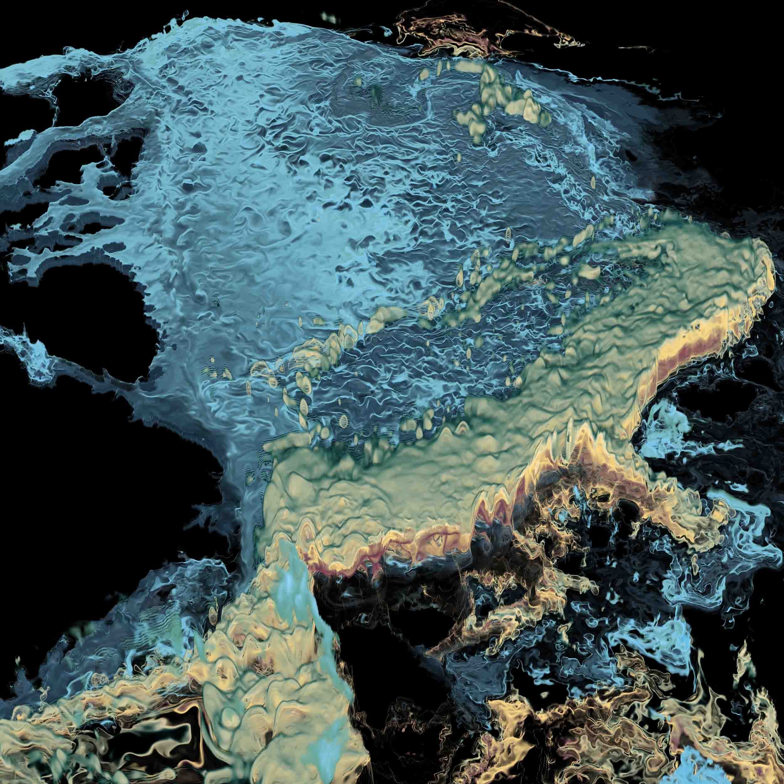
Circulation in the Arctic Ocean
Visualizing features of the evolving Arctic atmosphere with high performance computers

Increases in atmospheric temperatures have coincided with the shrinking of the Greenland ice sheet and Arctic glaciers, and a decrease in Arctic summertime sea ice coverage. An improved understanding of how heat and freshwater are transported by ocean currents is essential to assessing the impact of these changes on the Arctic climate system, on Greenland's contribution to global sea level rise, and on the global climate system.
Using the Stampede2 and Maverick supercomputers, and ParaView visualization software, TACC visualization expert Greg Foss illustrates daily-averaged subsurface seawater temperatures in the Arctic Ocean.
The differing salinity and temperature of the various waters entering the Arctic Ocean, as well as Earth's rotation and the steep bottom topography, all impact how these currents interact with each other, flow through, and impact the region.
Capturing detailed features is key for faithfully representing the complex and evolving Arctic atmosphere, ocean, and cryosphere systems, and is impossible without high performance computing resources.
Research:
An Nguyen, Arash Bigdeli, Victor Ocaña, and Patrick Heimbach
Institute for Computational Engineering and Sciences, Jackson School of Geosciences, UT Institute for Geophysics, UT Austin
Visualization:
Greg Foss
Texas Advanced Computing Center, UT Austin
Arctic map:
Jakobsson, M., L.A. Mayer, B. Coakley, J.A. Dowdeswell, S. Forbes, B. Fridman, H. Hodnesdal, R. Noormets, R. Pedersen, M. Rebesco, H.W. Schenke, Y. Zarayskaya A, D. Accettella, A. Armstrong, R.M. Anderson, P. Bienhoff, A. Camerlenghi, I. Church, M. Edwards, J.V. Gardner, J.K. Hall, B. Hell, O.B. Hestvik, Y. Kristoffersen, C. Marcussen, R. Mohammad, D. Mosher, S.V. Nghiem, M.T. Pedrosa, P.G. Travaglini, and P. Weatherall, The International Bathymetric Chart of the Arctic Ocean, Version 3.0, Geophysical Research Letters, maintained by: NOAA/NCEI & World Data Service for Geophysics

