

Visualizing Science
Faith Singer
The Physics of Fire
Visualizing wildfires for interactive exploration
The behavior of wildfires depends on many factors, including topography, weather, and properties of the burning vegetation. During the course of a fire, the blaze consumes fuel, heats and roils the atmosphere, and moves across varying terrain.
FIRETEC, developed by the Los Alamos National Laboratory (LANL) of the U.S. Department of Energy, is a physics-based 3D simulation of wildfires that allows scientists to predict the behavior of a fire under the current conditions as well as the expected effect of different firefighting strategies. It can also study wildfires over varying circumstances, enabling planners to optimize fuel-management strategies such as forest thinning and controlled burns.
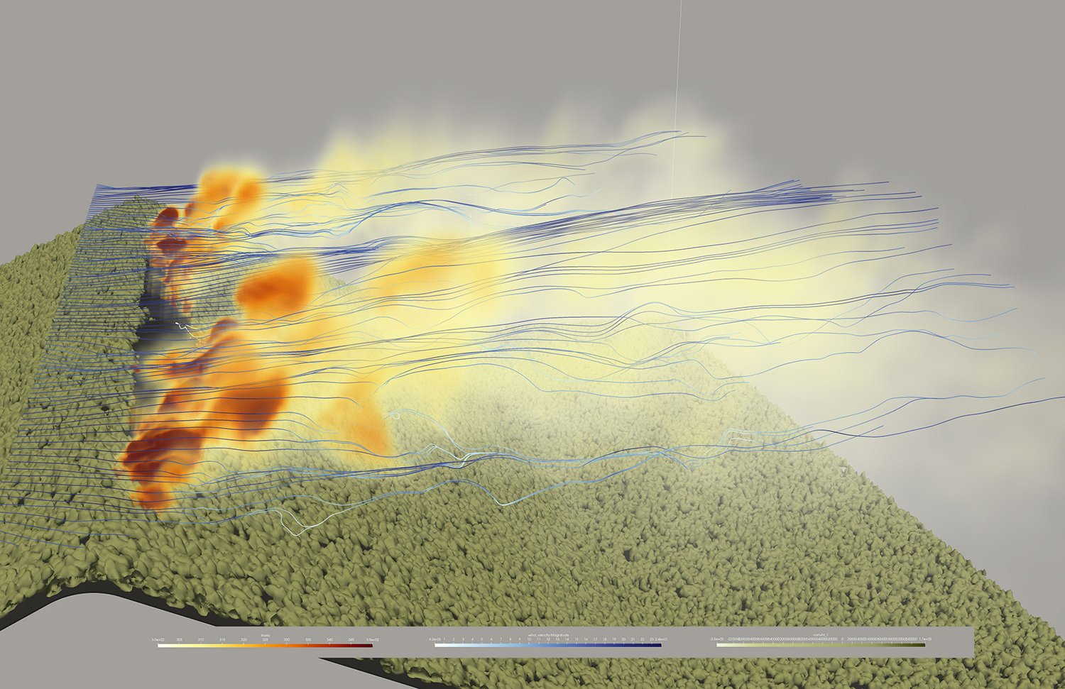
In these use cases, visualizing model results is vital to understanding them. This image illustrates a FIRETEC model after a fire has ignited on the down-wind slope of a ridge. Heat is visualized volumetrically to represent fire and smoke, streamlines are used to represent wind flow, and coloring is used to indicate properties of terrain vegetation.
Cinema, a tool also developed by LANL, enables the visualized results of different models, each rendered at unique time steps and from different viewpoints, to be placed into a database for interactive exploration.
Visualization credits: Rodman Linn, Los Alamos National Laboratory; Francesca Samsel and Greg Abram, Texas Advanced Computing Center